The best Bible atlases make unfamiliar places, journeys, borders, and historical events easier to understand. They combine maps with photos, timelines, cultural background, and archaeological context to give biblical narratives a clearer geographic framework.
This roundup compares 10 Bible atlases for different readers, from students and first-time buyers to teachers and serious Bible-study enthusiasts. Use the guide below to match the atlas format, depth, and visual style to your needs.
Best 10 Bible Atlases Picks for 2026
Best Comprehensive Visual Guide

- 3-D and multidimensional maps
- 100+ new images
- Geographical dictionary and index
Best For: Readers wanting a detailed, visually rich Bible atlas
Best Historical Context

- 132 full-color maps
- 100+ color photographs
- Covers peoples, empires, and ancient life
Best For: Teachers, pastors, and students studying biblical context
Best for Teaching
Deluxe Then and Now Bible Maps

- Eight modern-location overlays
- Lays flat with spiral binding
- Large type and reproducible maps
Best For: Classrooms, homeschool, and Bible study groups
Best Advanced Reference

- 175+ full-color maps
- Satellite and GIS-based presentation
- 3-D reconstructions and online resources
Best For: Serious students and ESV readers wanting extensive mapping detail
Best Visual Reference

- More than 300 maps, charts, photos, and reconstructions
- Covers major biblical journeys and events
- Compact format for study or group use
Best For: Beginners wanting a portable, visual Bible geography guide
Best Context-Focused Atlas
Rose Then and Now Bible Map Atlas

- More than 120 detailed Bible maps
- Modern-location overlays clarify places today
- Connects geography to 30 Bible characters
Best For: Readers seeking cultural and character-focused context
Best Compact National Geographic Pick
National Geographic Atlas of the Bible

- Explores the Holy Lands
- Concise 112-page format
- Larger page dimensions for easy viewing
Best For: Readers wanting a short Holy Lands reference
Best Scholarly Reference
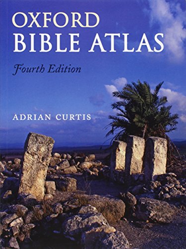
- 27 full-color maps and 81 illustrations
- Covers Genesis through the early Church
- Includes indexes, chronology, and archaeology content
Best For: Bible students and serious reference use
Best Budget-Friendly Pick

- 30 maps cover both Testaments
- Designed for clear, accessible learning
- Includes a place-name index and archaeology guide
Best For: Readers ages 9–12 and Bible geography beginners
Best Visual History Guide
The IVP Atlas of Bible History

- 97 maps span three thousand years
- Includes 150+ visual illustrations and site plans
- Connects geography, archaeology, and biblical history
Best For: Readers wanting an image-rich historical overview
Best Comprehensive Visual Guide – Zondervan Atlas of the Bible
Zondervan Atlas of the Bible: Revised Edition, Full-Color Maps, Photos, Graphics, and More
Check Price On AmazonFor readers seeking comprehensive bible atlases, the revised Zondervan Atlas of the Bible combines full-color maps, photographs, graphics, and chronological presentation. It moves from the geography of the biblical world through the historical progression of the Old and New Testaments, then adds resources for deeper reference.
Best For: Bible students and readers who want an expansive, visually rich reference atlas.
Pros:
- Features multidimensional and three-dimensional maps.
- Includes more than 100 new topic-related images.
- Offers chronological charts, a geographical dictionary, and an index.
Cons:
- Its 304-page format may be more extensive than casual readers need.
- At 2.6 pounds, it is better suited to desk or study use than portable reading.
This is a strong all-around choice when visual presentation and detailed geographic reference matter more than compactness.
Best Historical Context – Holman Bible Atlas
Holman Bible Atlas: A Complete Guide to the Expansive Geography of Biblical History
Check Price On AmazonThe Holman Bible Atlas is a practical pick among bible atlases for connecting biblical events with geography, history, and culture. Its content follows major biblical history periods and specific biblical texts, supported by maps, photographs, timelines, charts, and sidebars.
Best For: Teachers, pastors, and students studying biblical events within their historical and cultural settings.
Pros:
- Includes 132 full-color maps and more than 100 color photographs.
- Covers geography from the Ancient Near East through the Christian era to Constantine.
- Adds information on peoples, empires, roads, agriculture, and economic life.
Cons:
- The 256-page layout may provide less space than longer atlas references.
- Its 3.25-pound weight makes it relatively substantial for carrying.
Choose this atlas if your priority is understanding the geographic and cultural background surrounding biblical history.
Best for Teaching – Deluxe Then and Now Bible Maps
For classrooms, homeschool settings, and group study, Deluxe Then and Now Bible Maps offers an accessible alternative among bible atlases. Clear plastic overlays place modern cities and countries over Bible maps, while the spiral binding, larger type, charts, and story-focused maps support hands-on use.
Best For: Sunday school teachers, homeschool families, and readers who want quick visual comparisons between ancient and modern geography.
Pros:
- Includes eight clear plastic overlays for modern geography.
- Spiral binding allows pages to lie flat when open.
- Features updated maps, timelines, Bible charts, and story maps.
Cons:
- At 66 pages, it is less comprehensive than full-length reference atlases.
- The emphasis on teaching and visual comparison may not satisfy readers seeking extensive narrative detail.
This is the most classroom-friendly option in the group, especially when easy viewing and modern-location comparisons are priorities.
Best Advanced Reference – Crossway ESV Bible Atlas
The Crossway ESV Bible Atlas suits readers who want technically informed bible atlases without giving up readability. It combines satellite imaging and geographic information systems with more than 175 maps, photographs, 3-D reconstructions, timelines, indexes, and substantial narrative coverage.
Best For: ESV readers and serious students seeking a detailed, modern reference for biblical geography and history.
Pros:
- Includes more than 175 full-color maps and 70 photographs.
- Uses satellite imaging and GIS-based geographic presentation.
- Provides regional maps, 3-D site and object reconstructions, timelines, and online resources.
Cons:
- Its 352 pages and 1.4-inch thickness make it a substantial desk reference.
- The technical scope may be more than casual Bible readers require.
Consider this atlas when you value broad regional coverage, modern mapping methods, and extensive explanatory material in one volume.
Best Visual Reference – Ultimate Bible Atlas
For shoppers seeking approachable bible atlases, the Ultimate Bible Atlas combines more than 300 full-color maps, charts, photographs, and reconstructions. Its coverage follows major biblical events from Abraham’s journeys and the Exodus through Jesus’ ministry and Paul’s missionary work, while its compact format suits personal study or group activities.
Best For: Beginners and readers who want a compact, highly visual overview of biblical geography and events.
Pros:
- Includes more than 300 maps, charts, photos, and reconstructions.
- Covers both Old and New Testament settings, including Passion Week and Paul’s journeys.
- Compact 4.8-by-7-inch format is easy to carry and use.
Cons:
- Its beginner-friendly scope may feel less specialized for advanced atlas users.
- Compact dimensions may provide less viewing space than a larger-format atlas.
The revised and expanded edition offers broad visual coverage in a portable package, making it a practical starting point for studying how geography shaped biblical narratives.
Best Context-Focused Atlas – Rose Then and Now Bible Map Atlas
The Rose Then and Now Bible Map Atlas is a strong choice among bible atlases for readers who want explanations alongside maps. It combines more than 120 detailed maps with modern-location overlays, travel routes, Bible references, and cultural background focused on 30 important Bible characters.
Best For: Students who want to connect biblical geography with people, decisions, culture, and historical context.
Pros:
- Pairs more than 120 maps with explanatory background information.
- Clear overlays connect biblical locations with modern cities and countries.
- Explores how geography affected figures such as David, Naomi, and Moses.
- Maps include travel directions, notes, and Bible references.
Cons:
- At 3.1 pounds, it is substantially less portable than a compact atlas.
- Its people-centered approach may be less suitable for readers seeking primarily regional maps.
With its combination of maps, overlays, and character-focused commentary, this atlas is designed for readers who want to understand not just where biblical events occurred, but why the setting mattered.
Best Compact National Geographic Pick – National Geographic Atlas of the Bible
Readers comparing bible atlases may appreciate the National Geographic Atlas of the Bible as a compact exploration of the Holy Lands. Its 112-page format and National Geographic publication provide a concise option for readers who prefer a shorter atlas in a larger page layout.
Best For: Readers wanting a concise, easy-to-handle introduction to the Holy Lands.
Pros:
- Focuses specifically on exploring the Holy Lands.
- Compact 112-page length is approachable for quick reference.
- Large 8-by-10.88-inch page dimensions offer more display area than a pocket-sized atlas.
Cons:
- Provides fewer pages than the other supplied atlas options.
- The available product details do not specify the number of maps or additional features.
This is a straightforward choice for shoppers who want a shorter Holy Lands reference rather than a lengthy, feature-heavy study volume.
Best Scholarly Reference – Oxford Bible Atlas
For readers seeking authoritative bible atlases, the fourth-edition Oxford Bible Atlas combines historical context, archaeology, topography, and detailed cartography. Its broad coverage makes it a strong reference for studying how biblical events relate to the ancient world.
Best For: Bible students, teachers, and readers who want a substantial scholarly reference covering both Testaments and their historical settings.
Pros:
- Includes 27 full-color maps and 81 color illustrations.
- Covers biblical history from Genesis through the early Church.
- Adds chronology, place-name and general indexes, archaeology discussion, and further-reading suggestions.
Cons:
- Its scholarly scope may be more than casual readers need.
- At 229 pages and 2.31 pounds, it is less of a lightweight companion.
Choose this atlas when depth, historical range, and reference features matter more than portability. The updated maps and archaeology-focused material give it lasting value for serious study.
Best Budget-Friendly Pick – The Student Bible Atlas
The Student Bible Atlas is a practical choice among bible atlases for younger readers and anyone who wants an accessible visual overview. Its revised layout, colorful maps, and concise presentation focus on the major journeys and places found in both Testaments.
Best For: Students ages 9–12, grades 4–7, families, and beginners looking for an approachable Bible geography aid.
Pros:
- Provides 30 maps covering the Old and New Testaments.
- Uses a clear, concise, colorful format.
- Includes a place-name index and a guide to major Middle Eastern archaeological sites.
Cons:
- Its 32-page format offers less depth than larger reference atlases.
- The reading level and grade focus may not suit advanced study.
This is the most accessible option of the three, especially for classroom or family use. It emphasizes essential information without overwhelming new Bible students.
Best Visual History Guide – The IVP Atlas of Bible History
The IVP Atlas of Bible History stands out among bible atlases for its narrative approach and extensive visual material. It connects geography, archaeology, culture, and major biblical events across three thousand years, making the historical story easier to follow.
Best For: Readers who want a readable, image-rich guide to biblical history spanning the Old and New Testaments.
Pros:
- Includes 97 maps covering the biblical narrative.
- Features more than 150 color photographs, panoramic illustrations, and site plans.
- Explores peoples, languages, geography, climate, culture, and religion.
Cons:
- Its 3-pound size may be cumbersome for frequent carrying.
- The broad historical scope may be more than readers seeking only basic maps need.
Pick this atlas if you learn best through a combination of maps, images, and narrative explanation. Its coverage from Abraham to Paul provides a broad visual framework for understanding Scripture’s historical setting.
How We Picked These Bible Atlases
We selected these Bible Atlases for their usefulness, clarity, visual quality, and coverage of biblical geography and history. The lineup includes broad reference works, student-friendly introductions, historical atlases, and map-focused volumes with photographs, reconstructions, or “then and now” comparisons.
We also considered how easily each atlas can support common tasks: following biblical journeys, understanding ancient kingdoms, preparing lessons, researching historical settings, and comparing locations across different periods. Since readers have different goals, the selection balances academic depth with accessibility rather than treating one format as best for everyone.
Quick Comparison
- Best all-around reference: Zondervan Atlas of the Bible
- Best for comprehensive historical coverage: Holman Bible Atlas
- Best for visual comparisons: Deluxe Then and Now Bible Maps
- Best for ESV readers: Crossway ESV Bible Atlas
- Best for photography and reconstructions: Ultimate Bible Atlas
- Best for cultural background: Rose Then and Now Bible Map Atlas
- Best for National Geographic visuals: National Geographic Atlas of the Bible
- Best compact reference: Oxford Bible Atlas
- Best for younger or beginning students: The Student Bible Atlas
- Best for chronological study: The IVP Atlas of Bible History
Key Buying Factors for Bible Atlases
Map Detail and Readability
Look for maps with clear labels, useful scale, legible type, and enough geographic detail for the passages you study. A visually impressive atlas is less helpful if locations are difficult to find.
Historical and Cultural Context
Some books focus primarily on geography, while others explain empires, archaeological sites, trade routes, political boundaries, and daily life. Choose the balance that fits your study habits.
Visual Features
Photos, satellite views, charts, timelines, reconstructions, and modern-versus-ancient comparisons can make locations easier to remember. These features are especially valuable for teaching and visual learners.
Size and Portability
Large, detailed volumes work well on a desk or classroom lectern. A smaller atlas is more convenient for church, travel, or carrying alongside a study Bible.
Audience and Depth
Students and new readers may benefit from concise explanations and uncluttered maps. Advanced readers may prefer more extensive historical notes, period-by-period coverage, and archaeological discussion.
Who Should Buy Which Bible Atlases?
Choose a broad reference such as the Zondervan Atlas of the Bible or Holman Bible Atlas if you want one dependable volume for regular study. Readers who learn best through visual evidence should consider the National Geographic Atlas of the Bible, Ultimate Bible Atlas, or a then-and-now title.
For classroom instruction, family learning, or an accessible starting point, The Student Bible Atlas is a practical choice. Those studying biblical events in sequence may prefer The IVP Atlas of Bible History, while readers seeking a compact traditional reference can look to the Oxford Bible Atlas. If you use the ESV heavily, the Crossway ESV Bible Atlas offers a natural fit with that study ecosystem.