If you want to see Scripture’s settings with greater clarity, a good atlas can make a major difference. A Bible atlas with satellite maps helps connect biblical events to real terrain, routes, cities, and regions.
Below, we focus on ten strong options for study, teaching, and personal reference, with an eye toward readability, historical depth, and visual usefulness.
Best 10 Bible Atlas with Satellite Maps Picks for 2026
Satellite-Map Focus

- 85 full-page color maps
- Biblical events marked on satellite imagery
- Geographical and historical commentary
Best For: Readers who want a focused atlas centered on satellite imagery and event markers.
Regional Satellite Study
Holy Land Satellite Atlas, Vol. 2

- Color satellite maps throughout
- Most maps include location identifiers
- Back-pocket Holy Land satellite map
Best For: Study users who want a region-based satellite atlas with identifiers and a pocket map insert.
All-Purpose Bible Atlas

- Full-color multidimensional maps
- Over 100 images and graphics
- Geographical dictionary and index
Best For: Students and readers who want a broad, accessible Bible atlas with maps, images, charts, and reference tools.
Simple Satellite Atlas
Holy Land Satellite Atlas, Vol. 1
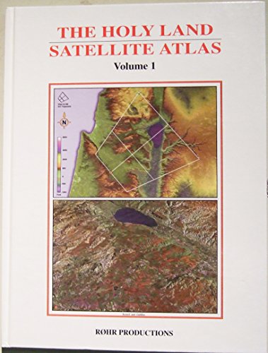
- Dedicated Holy Land satellite atlas
- 248-page reference volume
- Compact map-focused format
Best For: Readers who want a simple, dedicated Holy Land satellite atlas in a concise format.
Bible Context Atlas
Bible Background and Culture Atlas

- Over 120 Bible maps with overlays
- Background on 30 Bible characters
- Travel routes and explanatory notes
Best For: Bible study readers who want context-rich maps
World Satellite Atlas

- High-clarity satellite images
- Covers six continents and major landmarks
- Captions add facts and context
Best For: Readers who want a visual world geography atlas
Compact Bible Atlas
Zondervan Essential Atlas of the Bible

- Nearly 200 maps in a compact format
- Photos, diagrams, and charts included
- Updated mapping and historical charts
Best For: Bible students and travelers wanting a concise study atlas
Scholarly Reference Pick
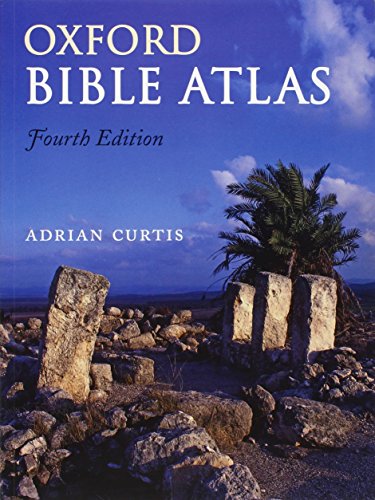
- 4th edition with updated scholarship
- 27 full-color maps and 81 illustrations
- Covers Genesis to early Church history
Best For: Readers who want a detailed, academic Bible geography reference
Balanced Study Atlas

- Full-color maps, photos, and illustrations
- Gives clear context for the biblical narrative
- Revised edition with 352 pages
Best For: Readers seeking a practical, easy-to-use Bible study atlas
Kid-Friendly Visual Pick
The Bible Atlas: Pictorial Guide

- Built for ages 9-12
- Beautifully drawn maps and illustrations
- Shows Bible events and ancient life visually
Best For: Kids who need an engaging, easy-to-follow Bible atlas
Satellite-Map Focus – Satellite Bible Atlas
If you want a bible atlas with satellite maps that ties biblical events directly to enhanced aerial imagery, this 2nd edition is built for that job. It includes 85 full-page color maps with events marked on the maps, plus geographical and historical commentary to help you connect places with the biblical storyline.
Best For: Readers who want a focused atlas centered on satellite imagery, map-based study, and event markers.
Pros:
- 85 full-page color maps give you a substantial visual reference set.
- Biblical events are marked on enhanced satellite imagery for easier context.
- Includes geographical and historical commentary alongside the maps.
- Compact 148-page format from a second edition release.
Cons:
- At 148 pages, it is shorter than some broader atlases.
- Its emphasis is on satellite mapping rather than a wide general Bible reference library.
This is a strong pick if your priority is a practical bible atlas with satellite maps that stays tightly focused on the land, locations, and events of Scripture.
Regional Satellite Study – Holy Land Satellite Atlas, Vol. 2
This bible atlas with satellite maps is organized around the regions of the Holy Land and gives you a heavily illustrated, map-driven view of biblical geography. The volume includes color satellite maps, location identifiers on most maps, and a Holy Land satellite map stored in the back pocket for quick reference.
Best For: Study users who want a region-based satellite atlas with built-in map identifiers and a pocket map insert.
Pros:
- Profusely illustrated with color satellite maps.
- Most maps include location identifiers for easier navigation.
- Includes a Holy Land satellite map in the back pocket.
- Comprehensive 249-page volume with a clear regional focus.
Cons:
- The older publication date may matter if you want the newest presentation style.
- Its structure is specialized around regions rather than a broad general survey.
If you want a region-by-region visual companion, this atlas offers a useful mix of satellite imagery, identifiers, and a handy pocket map.
All-Purpose Bible Atlas – Zondervan Atlas of the Bible
Zondervan Atlas of the Bible: Revised Edition, Full-Color Maps, Photos, Graphics, and More
Check Price On AmazonFor buyers who want a bible atlas with satellite maps plus a broader study resource, this revised Zondervan edition offers a visual and historical overview of Scripture. It combines full-color maps, photos, graphics, chronological charts, and a geographical dictionary, making it useful when you need more than just maps.
Best For: Students and readers who want a broad, accessible Bible atlas with maps, images, charts, and place-name reference tools.
Pros:
- Stunning multidimensional and three-dimensional maps.
- Over 100 relevant images add visual context.
- Includes revised text, chronological charts, and graphics.
- Has a complete geographical dictionary and index for deeper study.
Cons:
- It is a broad atlas, so it is less specialized in satellite imagery than some dedicated options.
- At 304 pages, it may feel more like a full reference than a quick map book.
This is a strong all-around choice if you want an atlas that balances maps with historical explanation and study aids.
Simple Satellite Atlas – Holy Land Satellite Atlas, Vol. 1
This bible atlas with satellite maps is a straightforward volume for readers who want a dedicated Holy Land satellite reference without extra framing. With 248 pages and a compact, atlas-style format, it suits buyers looking for a practical map companion focused on the Holy Land.
Best For: Readers who want a simple, dedicated Holy Land satellite atlas in a concise format.
Pros:
- Dedicated Holy Land satellite atlas format.
- 248 pages provide a substantial reference length.
- Compact and practical for map-focused use.
Cons:
- The supplied notes give limited detail on map features and extras.
- It does not mention labels, pocket inserts, or commentary.
If you mainly want the atlas itself and do not need a lot of extras, this volume is a simple entry in the satellite-map Bible atlas category.
Bible Context Atlas – Bible Background and Culture Atlas
If you want a bible atlas with satellite maps that goes beyond simple place names, this volume adds more context than most. It combines over 120 detailed Bible maps with clear plastic overlays of modern cities and countries, plus background on people, places, and travel routes to help you see how geography shaped the biblical story.
Best For: Bible readers and students who want map detail plus cultural and historical context for key people and events.
Pros:
- Includes over 120 detailed Bible maps.
- Uses clear overlays to show modern cities and countries alongside biblical locations.
- Focuses on 30 important Bible characters and how geography affected their decisions.
- Maps include travel directions and helpful notes.
Cons:
- It is more focused on Bible study context than on broad world coverage.
- At 272 pages, it is a substantial reference book rather than a quick-flip atlas.
This is a strong choice if you want an atlas that explains why locations matter, not just where they are. The added background and overlays make it especially useful for serious Bible study.
World Satellite Atlas – Satellite Atlas of the World
This satellite atlas is a good fit if you want a general-purpose reference that shows the Earth from above in striking detail. It uses the latest satellite technology to present countries, seas, mountains, lakes, and major cities with clear images, making it useful for geography-minded readers who prefer a visual approach.
Best For: Geography and photography enthusiasts who want a large-format satellite view of the world.
Pros:
- Uses satellite imagery with high clarity and color.
- Covers six continents with progressively closer views.
- Includes familiar landmarks and major cities.
- Captions add historical and statistical information.
Cons:
- It is a general world atlas, not a Bible-specific reference.
- Its large size and weight make it less convenient to carry around.
Choose this if your priority is a visually impressive satellite atlas rather than biblical study tools. It offers strong image quality and broad geographic coverage in a presentation-heavy format.
Compact Bible Atlas – Zondervan Essential Atlas of the Bible
For shoppers looking for a bible atlas with satellite maps feel in a compact study format, this atlas offers a practical mix of maps, photos, diagrams, and charts. It is designed to help you understand the lands of the Bible through nearly 200 multidimensional and three-dimensional maps, along with updated mapping technology and clear historical context.
Best For: Bible students and Holy Land travelers who want a concise but detailed atlas for study and reference.
Pros:
- Nearly 200 multidimensional and 3D maps.
- Full-color photos, diagrams, and charts support the maps.
- Uses accurate and up-to-date mapping technologies.
- Includes chronological charts and maps for historical background, weather, and roads.
Cons:
- With 160 pages, it is more concise than larger Bible atlases.
- Its smaller size may feel less expansive than a full reference atlas.
This is a smart option if you want an accessible Bible atlas that still covers a lot of ground. The combination of modern mapping, visuals, and concise organization makes it easy to use for study and quick reference.
Scholarly Reference Pick – Oxford Bible Atlas
If you want a bible atlas with satellite maps-style geographic context, the Oxford Bible Atlas is built for readers who want an authoritative overview of the biblical world. This fourth edition has been thoroughly revised with up-to-date biblical scholarship, archaeology, and topography, and it uses 27 full-color maps to trace the settings of Scripture from Genesis through the New Testament.
Best For: Students, teachers, and serious readers who want a detailed, academically grounded atlas of biblical geography.
Pros:
- Thoroughly revised fourth edition with current scholarship and archaeology
- 27 full-color maps plus 81 color illustrations
- Covers major biblical eras, trade routes, empires, and early Church history
- Includes chronology, indexes, and further reading
Cons:
- More reference-oriented than a simple picture atlas
- Likely better for study than quick casual browsing
Overall, this is the strongest choice if your priority is accuracy, historical depth, and a well-rounded guide to the geography behind the Bible.
Balanced Study Atlas – Baker's Bible Atlas
Baker’s Bible Atlas is a practical bible atlas with satellite maps-style context for readers who want a broad visual guide to the biblical narrative. It includes full-color maps, illustrations, and photographs to help place events in their geographical setting across the whole Bible.
Best For: Readers who want a straightforward, full-color atlas that supports general Bible study.
Pros:
- Full-color maps, illustrations, and photographs
- Provides clear geographical context for the entire biblical narrative
- Revised edition with a substantial 352 pages
Cons:
- Less specialized than a scholarly reference atlas
- No detailed feature list beyond the visual study materials
This is a solid middle-ground option if you want an accessible atlas that combines map-based understanding with enough visual detail to support regular reading and study.
Kid-Friendly Visual Pick – The Bible Atlas: Pictorial Guide
If you need a bible atlas with satellite maps-style visual appeal for younger readers, this DK pictorial guide is designed to make biblical geography easy to follow. It uses beautifully drawn maps, illustrations, and photos to show where Old and New Testament events took place and how people lived in biblical times.
Best For: Children ages 9-12 who learn best with colorful maps, visuals, and simple explanations.
Pros:
- Designed specifically for ages 9-12
- Illustrated maps show key Bible events and travel routes
- Includes visuals and photos explaining ancient life and modern locations
- Accessible, page-by-page format for young readers
Cons:
- Shorter 64-page format offers less depth than adult atlases
- Focused on children rather than advanced study
For families or classrooms, this is the most approachable choice, blending clear maps with engaging visuals so kids can understand the Bible’s geography without getting overwhelmed.
How We Picked the Best Bible Atlas with Satellite Maps
We prioritized atlases that combine biblical geography with practical map detail, strong editorial reputation, and helpful visual aids such as photographs, region summaries, timelines, and historical overlays. For a Bible Atlas with Satellite Maps, clarity matters as much as scholarship, so we favored books that help readers orient themselves quickly without sacrificing accuracy.
Quick Comparison
Some titles lean more academic, while others are designed for approachable study and visual learning. If you want the most teaching-friendly choice, look for atlases with fuller annotations and background sections. If you want fast reference, choose a more concise format with clean maps and straightforward labels. A Bible Atlas with Satellite Maps works best when it balances modern terrain views with biblical-era context.
Key Buying Factors for Bible Atlas with Satellite Maps
Map Style and Readability
Check whether the atlas uses satellite imagery, relief maps, or hybrid layouts. The best versions make it easy to compare ancient sites with present-day geography. Labels should be legible, and color contrast should remain strong across multiple pages.
Historical and Biblical Coverage
Look for atlases that include major biblical periods, key journeys, tribal territories, kingdoms, and New Testament locations. A stronger Bible Atlas with Satellite Maps should do more than show places; it should explain why those places matter.
Supplemental Content
Background notes, timelines, cultural context, and location indexes are all valuable. These extras help readers move beyond map browsing and use the atlas for actual study, lesson prep, or sermon development.
Format and Use Case
Large-format atlases usually offer more detail and are better for desk study. Compact editions are easier to carry to class or church. Consider whether you want a teaching tool, a devotional reference, or a more academic resource.
Who Should Buy Which Bible Atlas with Satellite Maps?
Teachers and pastors should favor atlases with strong explanatory notes, broad biblical coverage, and high readability. Students and new readers may prefer more visual, accessible editions that make locations and journeys easier to grasp. Serious researchers may want a more detailed scholarly atlas with deeper historical framing. If you are mainly looking for a Bible Atlas with Satellite Maps to enrich personal study, choose the one that matches your preferred balance of detail, size, and ease of use.
In short, the right atlas is the one that helps you connect the biblical text to the land in a way that is clear, useful, and memorable.